Here it is!
We entered it into the Stroud International Pairings II Video Open
Check out the site!


Life is full of journeys – physical, emotional and spiritual. Our personal journeys, the paths we choose – consciously or unconsciously, twisting, turning, advancing, retreating – and the invisible marks that we leave behind as we travel are represented in these strip maps.


Dynamic stitched architectural installations, pushing the boundaries of textiles to construct vibrant three-dimensional ‘drawings’ in space.
Fascinated by patterns of change over time, Glasbrook uses brightly coloured threads to plot and contain space as markers of this process

My current work and thinking relates to the culture of collecting, objects as identity and the auto suggestive nature of seemingly random possessions, and the importance we invest in insignificant trifles. It is a concept I intend to expand as a method of presenting 3d narrative on selected themes
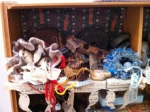
Setting up day photo – in the middle of sorting and arranging…


This piece, although new, was not developed specially for the ‘Mapping’ exhibition as I was working on it some six months before the TFSW was proposed – but it fitted into the TFSW brief so well!.
I have always loved maps & especially old ones for the stories they tell beyond the simply geographic, and the subject seemed an ideal choice for exploring ways of using Vanishing Muslin to represent aged & distressed fabric rather than – as it is mainly used – just as an alternative to water-soluble film.
At the same time I was able to explore the use of an unfamiliar automatic stitch – ragged satin stitch – which I had found on my new Husqvarna machine, and use up some previously space-dyed fabric from my stash.
Design inspiration : Medieval Maps, Monsters & Ancient & Modern Myths
The style of the map is based on the St Beatus world map which was painted by the monks of Abbey of Saint-Sever c1050 A.D. as an illustration to St Beatus’s C8th works including Commentary on the Apocalypse Its main goal is not to depict a geoographically exact depiction of the world and its continents, but to illustrate the primitive Diaspora of the Apostles, and it lies landscape with east at the top .
Medieval maps do typically contain written references or paintings of a wide variety of strange & mythical beasts, usually populating little known or unexplored areas of the world. The wording on my map derives from several medieval map sources –
In his locis cenocephali nascuntur” ( ‘in this place are the dog-headed men born’ or more colloquially – ‘the land of the dog-headed men’ ) is from from the ‘Tabula Peutingeriana’ which is a beautiful medieval copy of a Roman Imperial map. References to tribes of dog-headed men can be found widely in medieval literature & maps
The ‘draco'(dragon) in the extreme south-eastern part of Africa, together with the aspis (asp or serpent) and basiliscus (basilisk) can be found on The Ebstorf map (13th c.)
And the myth carries on………’Hic Dracones’ – here be dragons – or more accurately : “HC SVNT DRACONES” can be found on the Lenox Globe (ca. 1503-07, copper, 13cm in diameter currently in the collection of the New York Public Library) and it is located on the Globe near to the current location of the Kimodo Dragons Strangely enough, in research so far neither”HC SVNT DRACONES”nor .’Hic Dracones’ has been found on any other medieval map!.
So why our modern myth that ‘hic dracones’ – here be dragons -appears on many medieval maps representing dangers, or unknown places? Perhaps it got into early schools curricula because it was publicised by a critical assessment of the globe in an article for ‘The Magazine of American History’ in September 1879 ? Or perhaps – as for me –as a result of reading the Dorothy L. Sayers’ short story “The Learned Adventure of the Dragon’s Head” in ‘Lord Peter Views the Body’ in which a character refers to having seen “hic dracones” on an old map………
Anyway, here in a very simple piece (which is in serious need on conservation before it crumbles away completely) are layer upon layer of beliefs which date back from the 8th C to the present day – and probably on into the future while people still believe ‘hic dracones’ was the primary symbol for danger to the medieval map artists
I make textile wallhangings in the tradition of pieced quilting, using some fused appliqué as well, and some times incorporating text. I have always used strong colour in my work, and my maps are no exception to this.
I started making map quilts a few years ago by complete chance, as a response to a challenge, but then fell in love with the subject – I really like maps and geography – and continued making them.
Maps have been made by humankind since the birth of civilisation. They depict aspects of our earth and help us find our way. Different peoples used different materials – marks on clay, woven mats with shells, drawing and painting on vellum – whatever was the material that was most suitable to use at the time.
Maps represent the realities that we need or want to know about. For example, the large, elaborate maps that were made in Europe for kings and noblemen could enhance and enlarge the particular kingdom at the expense of the surrounding ones. The great explorers like Columbus needed to know how to sail West. Today, with satellite photography and GIS (Geographical Information Systems), we can start understanding our earth more fully, and use our knowledge for many other purposes -like protecting our planet.
My maps are sometimes imaginary, and sometimes loosely based in existing maps. The two pieces I will show at The Brewhouse are in fact one of each.
Cathedral Town – Harvest Time was inspired by a 1902 map of the city of Wells, Somerset, where I live, which I found in the Wells Museum. My textile map is by no means precise, but has the general feel and orientation of the town and its surroundings. The city area was much smaller then – it wasn’t a city yet – but the Cathedral of course has been there since 1100. So it has a prominent place in my map, carefully oriented East – West as it actually is. The river is there, with the then mill on it, some of the roads, and the railway line (in grey) – which does not exist any more, having been replaced by roads. The old hospital on the Glastonbury Road is now a modern Health Centre. I put in a number of yellow fields, therefore I feel it represents Harvest Time.

Cathedral Town-Harvest Time
On the other hand, City Lights is completely imaginary, and it is inspired by aerial views of towns, cities and roads, seen from an airplane at night.

City Lights
The pieces are quite big – over a metre in each direction, both of them. They got a heavily quilted, very textured surface which is difficult to see in the photographs above. So come to the Mapping the Future exhibition and see them ‘in the flesh’, and all the other wonderful work that will be on display there!
